How We Measured 7,149 m³ of Recycling Stockpiles in a Single Drone Flight
A LiDAR drone survey of five stockpiles at a Woolston recycling facility: over 7,000 m³ measured in one flight, accurate to within 2%, with site-specific tonnages.
By Art Ryumin5 min readWoolston, Christchurch
- measured in one flight
- 7,149 m³
- measured in one flight
- volumetric accuracy
- ±2%
- volumetric accuracy
- stockpiles, five materials
- 5
- stockpiles, five materials
- to final report
- < 1 week
- to final report
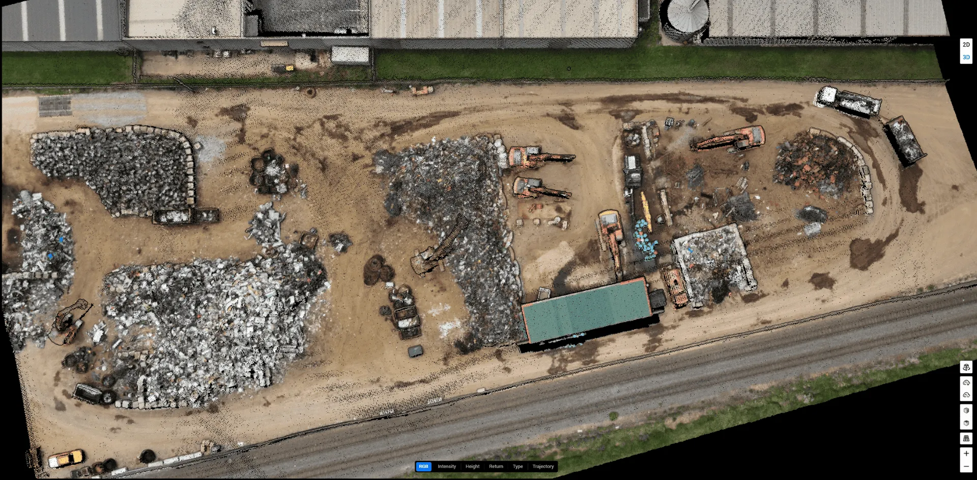
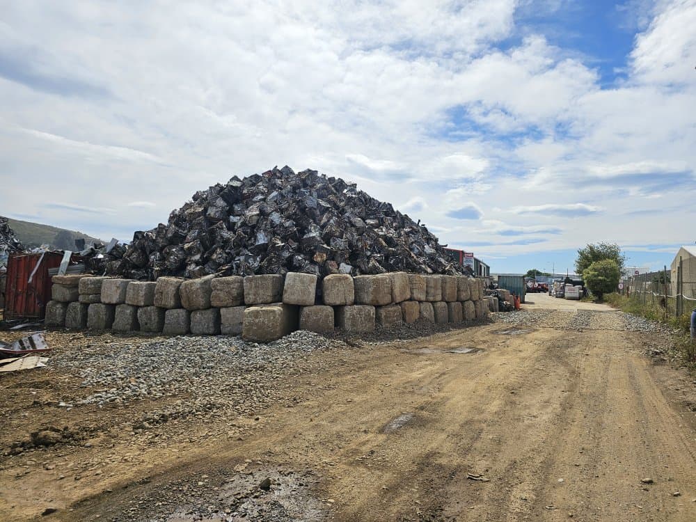
In early December 2025, we flew a LiDAR survey at a resource recycling facility in Woolston, Christchurch. The client needed accurate volume and weight measurements across five distinct stockpiles. Each was a different material with a different density, all in a working yard where operations couldn't stop.
One flight. Five stockpiles. 7,149 m³ of material measured. Results back within a week.
Here's how it worked, what we found, and why this kind of survey is fast becoming the standard for any New Zealand business that deals in bulk materials.
The problem with traditional stockpile measurement
If you've ever had to measure a stockpile the old way, you know how slow and inaccurate it can be. Someone walks the perimeter with a GPS unit or measuring wheel. Someone else climbs the pile, a health and safety issue in itself, to take height readings. The data goes into a spreadsheet, assumptions get made about the pile's shape, and you end up with a number that might be within 10–15% if you're lucky.
For a business managing significant material inventory, that error isn't acceptable. And for irregular piles with concave sections, overhangs or retaining walls, which describes most real-world stockpiles, manual measurement gets even less reliable.
The Woolston site had exactly this complexity: five stockpiles of different recycled materials, three of them partially retained by concrete block walls. Getting accurate volumes meant accounting for the walls themselves and subtracting them, which requires precise 3D data, not a tape measure.
What LiDAR actually does, in plain language
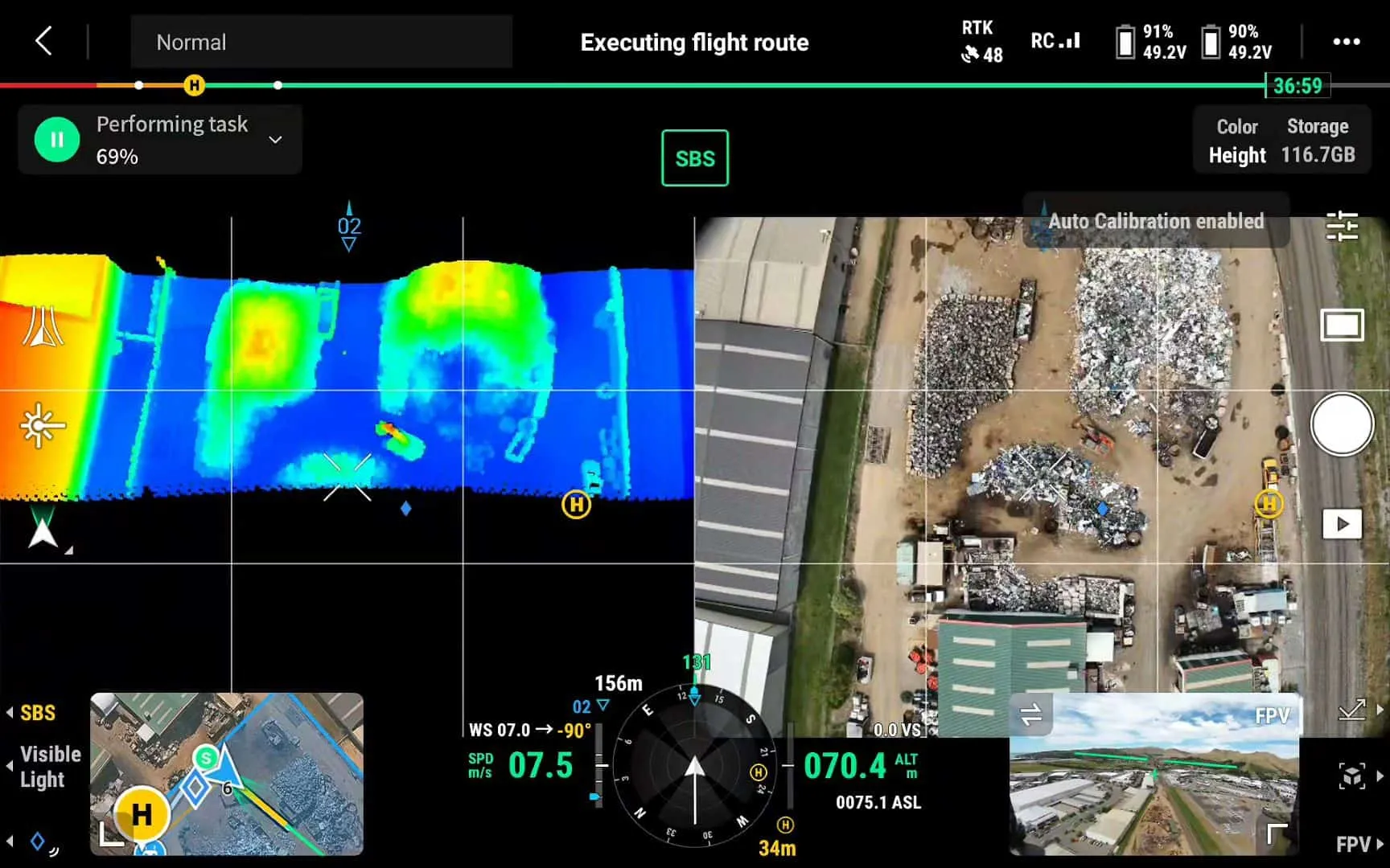
LiDAR stands for Light Detection and Ranging. Our DJI Zenmuse L2 sensor fires millions of laser pulses at the ground during the flight and measures how long each one takes to bounce back. From that we build a 3D point cloud: a dense, accurate digital map of everything the laser hit, including the ground, the stockpiles, the retaining walls and the machinery parked nearby.
The image above is what that looks like on our controller in real time. Every coloured dot is a laser return.
The L2 has a manufacturer-stated accuracy of 4 cm vertically and 5 cm horizontally. With live RTK (Real-Time Kinematic) GPS corrections, our volumetric results come in within ±2% of true volume, the industry benchmark for aerial LiDAR surveys.
How we ran this survey
We flew the DJI Matrice 350 RTK at 70 metres above ground level, at 10 m/s with 50% lateral overlap between passes. The LiDAR ran in repetitive scan mode with triple return, so each pulse captures up to three return signals. That's useful on complex material surfaces where a single return might miss detail.
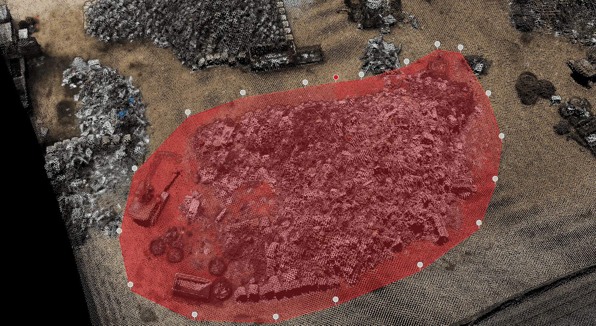
The resulting point cloud density was 1.89 cm per pixel, extremely high resolution for a site of this scale. In DJI Terra we classified ground points from stockpile points, manually delineated the base of each pile, and calculated volumes using a TIN (Triangulated Irregular Network) model.
For three of the five stockpiles, the scanned volume included retaining wall blocks. We measured each block type on site and deducted the total block volume:
- Stockpile 1: 20 concrete blocks, 12.72 m³ deducted
- Stockpile 3: 58 concrete blocks, 36.89 m³ deducted
- Stockpile 5: mixed irregular blocks, 12.56 m³ deducted
Without these deductions, the client would have received inflated quantities, which could affect inventory valuations, sale transactions or resource consent reporting. The detail matters.
Getting the weight right, not just the volume
Volume is only half the picture. What most bulk material businesses need is weight: how many tonnes they're holding. This is where generic density tables fall short.
Recycled and mixed materials have variable densities depending on composition, moisture content and processing. So on the day of the survey we filled circular bins with material from each stockpile, weighed them on site, and calculated a material-specific bulk density for each pile. The factors ranged from 0.141 t/m³ for the lightest material to 1.014 t/m³ for the densest, a sevenfold difference. A generic reference table would have produced wildly inaccurate weights across most of these piles.
The results
| Stockpile | Volume | Weight |
|---|---|---|
| Stockpile 1 | 3,192.81 m³ | 450.18 t |
| Stockpile 2 | 283.42 m³ | 167.50 t |
| Stockpile 3 | 1,430.00 m³ | 873.73 t |
| Stockpile 4 | 1,976.91 m³ | 891.58 t |
| Stockpile 5 | 265.94 m³ | 269.67 t |
| Total | 7,149.08 m³ | 2,652.66 t |
The client received a detailed report with annotated orthomosaic imagery, individual stockpile visualisations, site-specific density calculations and full methodology documentation. It covered everything needed for inventory management, site reporting and operational planning.
Who needs this kind of survey?
LiDAR stockpile surveys are relevant to any New Zealand business managing bulk materials:
- Quarries and aggregate suppliers tracking extracted and stored volumes
- Recycling and waste processing facilities managing inventory
- Civil contractors needing cut/fill calculations on earthworks
- Port and logistics operations managing bulk cargo
- Forestry operators tracking wood chip and biomass
- Farmers measuring grain, silage or soil stockpiles
- Mining operations requiring regular inventory reporting
If you hold, move or sell bulk material and you're measuring it by GPS walking, by estimation or not at all, a LiDAR survey will almost certainly pay for itself in accuracy on the first job.
Gallery