Request a Volumetrics Survey Today
Civil Volumetrics & Spatial Site Intelligence
Accurate Volume, Area & Site Data for Civil and Infrastructure Projects — Delivered as Point Cloud, 3D Model, or Photorealistic Walkthrough
Accurate Stockpile Volume Analysis, Road Measurements, and Site Development Insights Using Advanced LiDAR Scanning
Get fast, reliable data for your civil engineering projects with Drones at Work’s advanced volumetric services. Our LiDAR-equipped drone surveys deliver precise measurements for stockpiles, roads, earthworks, and development sites across New Zealand. From Christchurch to Auckland and beyond, we help you save time and reduce costs by leveraging cutting-edge drone technology that transforms how you measure, monitor, and manage your civil engineering assets.
What We Do
We specialize in civil volumetrics using the state-of-the-art DJI L2 LiDAR unit mounted on our DJI M350 RTK drone platform. This advanced scanning technology provides exceptionally accurate measurements for a wide range of applications, ensuring your projects stay on track and within budget through data-driven decision making.
Whether you’re managing a construction site, planning road maintenance, or developing a hillside property, our drone surveys deliver actionable data in a fraction of the time required by traditional surveying methods. Our background in civil quantity surveying allows us to translate complex scan data into clear, easy-to-understand volume calculations that directly support your project management and financial reporting needs.
Our Civil Volumetrics Services
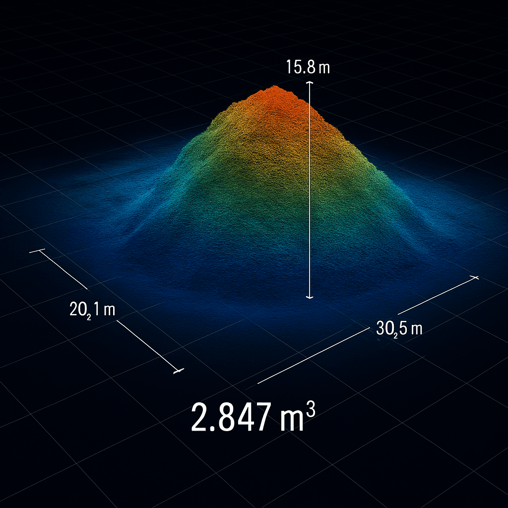
- Stockpile Volume Analysis: Accurately measure the cubic metre volume of dirt, gravel, aggregate, scrap metal, and other bulk material stockpiles — whether they’re in an open outdoor yard, a covered shed, or a confined space. We use the right tool for each situation: our M350 RTK drone with LiDAR for large outdoor stockpile yards, our Lixel K2 handheld scanner for indoor, confined, or smaller accessible stockpiles, and a hybrid approach for sites that have both. All three methods deliver the same centimetre-level accuracy and the same output: precise volume calculations for inventory management, financial reporting, and operational planning. Scrap metal and recycling yards are a particular strength — irregular pile shapes, mixed materials, and partially covered storage are exactly where LiDAR outperforms manual estimation. Our detailed reports include volume data, 3D visualisations, and comparative analysis for monitoring changes over time.
- Road and Infrastructure Measurements: Transform your road maintenance and construction planning with our detailed infrastructure scanning services. We precisely calculate the area of road surfaces, footpaths, shoulders, and grass verges, providing comprehensive dimensional data that supports maintenance planning, tender documentation, and budget allocation. Our drone road surveys can also be conducted at regular intervals to generate progress quantity reports during construction, allowing project managers to track completion rates, verify contractor work, and manage timelines more effectively. The precision of our LiDAR technology ensures measurements are accurate to within centimeters, eliminating estimation errors that can lead to cost overruns.
- Hill Site Development Surveys: Assess challenging hill sites for development with confidence using our specialized LiDAR scanning services. We provide accurate volume measurements and detailed topographic data that can be directly compared to design plans, ensuring your development proceeds according to specifications. Our LiDAR scanning for civil engineering delivers the precision needed for cut-and-fill calculations, site preparation planning, and earthworks optimization. This technology penetrates vegetation to reveal the true ground surface, providing insights that traditional surveys might miss and helping you identify potential challenges before they impact your project timeline or budget.
Why Choose Drones at Work for Civil Volumetrics?
Unmatched Precision
Our LiDAR technology delivers high-accuracy 3D models with point cloud densities that capture even subtle surface variations. This exceptional level of detail ensures reliable measurements for stockpiles, roads, and development sites, providing data you can confidently use for financial reporting, contract management, and operational planning.
Speed and Efficiency
Complete comprehensive surveys in hours, not days, with our drone volumetrics services. This dramatic reduction in survey time minimizes disruption to your operations, allows for more frequent monitoring, and accelerates the preparation of tender documents and progress claims. The efficiency of our process translates directly to cost savings and improved project agility.
New Zealand Wide Coverage
Based in Christchurch, we provide services throughout the South Island, North Island, and beyond, including remote locations like Stewart Island. Our mobile operation allows us to deploy quickly to your site, regardless of location, ensuring consistent service quality and timely data delivery across New Zealand.
Expertise You Can Trust
Our team brings specialized background in construction quantity surveying and licensed building practices to every project. This industry-specific knowledge ensures we understand the practical applications of the data we collect and can provide insights that directly support your project objectives and compliance requirements.
Stockpile Volume Measurement — Three Ways to Measure What You Have
Not all stockpiles are the same. Some are outdoors and easy to fly over. Some are in sheds, tunnels, or below-ground bunkers where a drone can’t go. And many sites have both. Drones At Work has the equipment to measure all of them — accurately, in a single visit if needed.
1. Small Accessible Stockpiles — Instant Volume with the Lixel K2
For stockpiles that are accessible from all sides — materials stored in a yard bay, aggregate in an open bunker, or product in an accessible shed — our Xgrids Lixel K2 handheld LiDAR scanner delivers volume data quickly, often on the same day as the site visit.
The K2 is walked around and over the stockpile, capturing a complete 3D model in minutes. Volume is calculated directly from the scan and reported immediately after processing. No flight planning, no CAA flight authorisation, no multi-day turnaround.
Ideal for: small to medium aggregate bays, product stockpiles accessible from all sides, situations needing a fast turnaround, and sites where a ground-based approach is more practical than a drone flight.
2. Large Outdoor Stockpile Yards — Aerial LiDAR with the M350 RTK
For large outdoor stockpile yards — quarries, ports, aggregate plants, and bulk material sites — our DJI M350 RTK drone with L2 LiDAR payload covers entire sites in a single flight at centimetre-level accuracy. The drone surveys ground that would take days to measure by hand, capturing every stockpile in the yard simultaneously.
Data is processed following the site visit and delivered as a full volumetric report: individual pile volumes, total site inventory, stockpile surface models, and a georeferenced 3D terrain dataset. Repeat surveys at scheduled intervals give you an accurate running inventory record over time.
Ideal for: quarry and mining operations, port and logistics yards, aggregate and concrete plants, and any site with multiple large stockpiles that need to be measured together efficiently.
3. Hybrid Sites — Aerial + Ground in a Single Visit
Many New Zealand sites have both: open-air stockpiles in the yard and covered material under a roof, in a processing shed, or in a below-ground bunker. A drone alone misses what’s inside. A ground scanner alone can’t efficiently cover a large open yard. Our hybrid approach combines both tools in a single site visit.
The M350 RTK handles the outdoor aerial survey while the K2 scans the covered and confined areas. Both datasets are georeferenced to the same coordinate system and merged into a single unified inventory report — complete site coverage, no gaps, one report.
Ideal for: aggregate yards with covered storage bays, quarry sites with tunnel or bunker stockpiles, processing plants with indoor and outdoor product storage, and port operations with covered sheds alongside open bulk material.
How It Works
1. Site Assessment
We begin by consulting with you to understand your specific project needs, whether it’s stockpile measurement, road assessment, or hillside development planning. This initial discussion helps us tailor our approach to deliver exactly the data you need in the most useful format for your application.
2. LiDAR Scanning
Using our advanced LiDAR system mounted on our RTK-enabled drone, we capture high-resolution 3D data of your site. The RTK (Real-Time Kinematic) positioning ensures centimeter-level accuracy, while the LiDAR sensor collects millions of data points that precisely map the entire survey area, even in challenging terrain or complex geometries.
3. Data Analysis
Our expert team processes the collected data using specialized software to calculate volumes, areas, and comparisons to design plans or previous surveys. This analysis transforms raw point cloud data into meaningful measurements and visualizations that directly address your project requirements.
4. Detailed Reporting
You receive a comprehensive report package with actionable insights tailored to your specific project needs. Our deliverables include detailed schedules of quantities for roading, cut-and-fill volumes for proposed and in-progress civil works, and precisely quantified civil project elements.
For client presentations and investor reporting, we also offer 3D Gaussian Splatting (3DGS) as a premium visualisation deliverable — a photorealistic, walkthrough-quality model of your entire site that can be shared via web link and viewed on any device.
For ongoing projects, we can conduct regular progress monitoring to quickly develop accurate progress claims based on volume or area measurements, helping you validate contractor work and maintain transparent project documentation.
Applications Across Industries
Construction Monitoring
Track earthworks progress and manage stockpile volumes with unprecedented accuracy. Our drone volumetrics provide construction managers with regular, reliable data for progress reporting, contractor payment verification, and resource planning throughout the project lifecycle.
Quarries and Mining
Optimize resource management with fast, accurate stockpile measurements that support inventory control, production planning, and financial reporting. Our volumetric analysis helps quarry operators track material movement, verify extraction volumes, and manage stockyard space more efficiently.
Land Development
Gain an in-depth understanding of your development site in hours rather than weeks. Our LiDAR technology penetrates vegetation to reveal important land features and potential issues like buried pits or uneven terrain that might not be visible in traditional surveys. This comprehensive site knowledge supports more accurate planning, reduces unexpected complications, and improves overall project efficiency.
Gravel and Material Suppliers
Quickly assess stock volumes of all materials in your supply yard without the need for time-consuming manual measurements. Our comprehensive scanning can inventory multiple stockpiles in a single survey, providing accurate volume data that supports sales operations, reordering decisions, and financial valuation.
Road Maintenance
Plan repairs and upgrades with precise measurements of roads and surrounding infrastructure. Our detailed area calculations and condition assessments help maintenance planners prioritize work, allocate resources effectively, and track the progress of upgrades with accurate before-and-after comparisons.
Drainage and Power Infrastructure
Capture detailed as-built reports that include precise GPS coordinates of buried services, complemented by high-resolution image maps showing installations and surrounding landmarks. This documentation proves invaluable for future maintenance, expansion planning, and compliance verification.
Development Projects
Ensure hill site developments align with design plans through regular comparative analysis. Our LiDAR scanning services help project managers verify earthworks progress, identify deviations from specifications, and document site conditions throughout the development process.
Ready to streamline your civil engineering project with precision data?
Contact Drones at Work today for LiDAR stockpile scanning, drone road surveys, and hill site and land development analysis across New Zealand.
Get a free quote
Open Hours
Monday – Friday: 8am – 6pm
Weekend appointments available by request
Office Location
Christchurch, New Zealand
Serving the entire South Island, North Island, and beyond

Drones at Work - Aerial, Thermal & Spatial Data Solutions Across New Zealand. CAA Part 102 Certified.